Showing posts with label trails. Show all posts

Sunday, April 26, 2015

Biking Through Nature, Past and Present: The Natchez Trace

Like plants and animals which adapt to their environment over time, how we travel has also evolved in response to changing circumstances.   I recently learned this first-hand on a spring bike trip in Mississippi.

The Natchez Trace is an ancient route that angles northeast from the lower Mississippi River to the rich farmlands of central Tennessee.  Historically, native Americans followed the paths, or traces, created by bison who wandered from the plains to salt licks in the Appalachians.  With European exploration and settlement, these footpaths consolidated into an important transportation route.  In the early 19th century, before the development of steamboats, Kentuckians and others would float farm goods down the Ohio and Mississippi River for sale, along with the wood used to make their flatboats.  They would return home, with their proceeds, on foot along the Natchez Trace.

The use of the Trace diversified with the War of 1812, as some of Andrew Jackson's troops travelled overland on foot to face the British in New Orleans.  Through its early history the trail served traders and innkeepers, preachers and proselytizers, and highwaymen and criminals.  By the end of the 19th century, the trail fell into disuse as first steamboats and then railroads became the preferred transportation system of the region.

The National Park Service helped revive the Natchez Trace as a Parkway in the 1930s, after a long campaign by history advocates, road boosters, and local congressmen.  The road was a Civilian Conservation Corps project to help move the South out of the depression, but World War II, limits on federal appropriations, and the rise of the interstate highway system delayed its completion, with the final segments not built until 2005

Today, the Natchez Trace Parkway runs for 444 miles from Natchez, Mississippi to just outside Nashville, Tennessee. The National Park Service maintains a number of historic sites, campgrounds, and visitor centers along its route.  Designed for leisurely driving, the speed limit is set at 50 miles per hour, access points are limited, and commercial truck traffic is prohibited.  It makes for one of the nicest bicycle trips I have ever taken on a road designed for automobile transportation.  And on the one occasion of an equipment failure beyond our abilities to repair, a Park Service ranger soon arrived to lend assistance.


Bicycling in Nature is a special way to experience the out-of-doors.  One travels faster than by walking, but still the environment is fully present in sight, sound, and smell (read more here about my thoughts on the environmental joys and spiritual benefits of biking).  The Natchez Trace in April was warm, the trees were leafing out, and the dogwood were in bloom.  Reptiles came out of hibernation, and snakes and turtles were on the move; we helped some, but sadly not all, cross the pavement.


Because of its development as a Parkway, the amount of structures on the route is quite limited and we enjoyed peaceful pedals through mature hardwood forests, took in park-like open spaces, and enjoyed a short walk through a flooded cypress and tupelo forest.  The regulated traffic and considerate drivers made it a pleasant trip, except for the morning we rode in a heavy rain.  There are quiet pull-offs with historical and natural interpretative signs, but being initially designed for motor traffic, the length between water and bathroom facilities is a bit longer than ideal for this two-wheeled traveller.
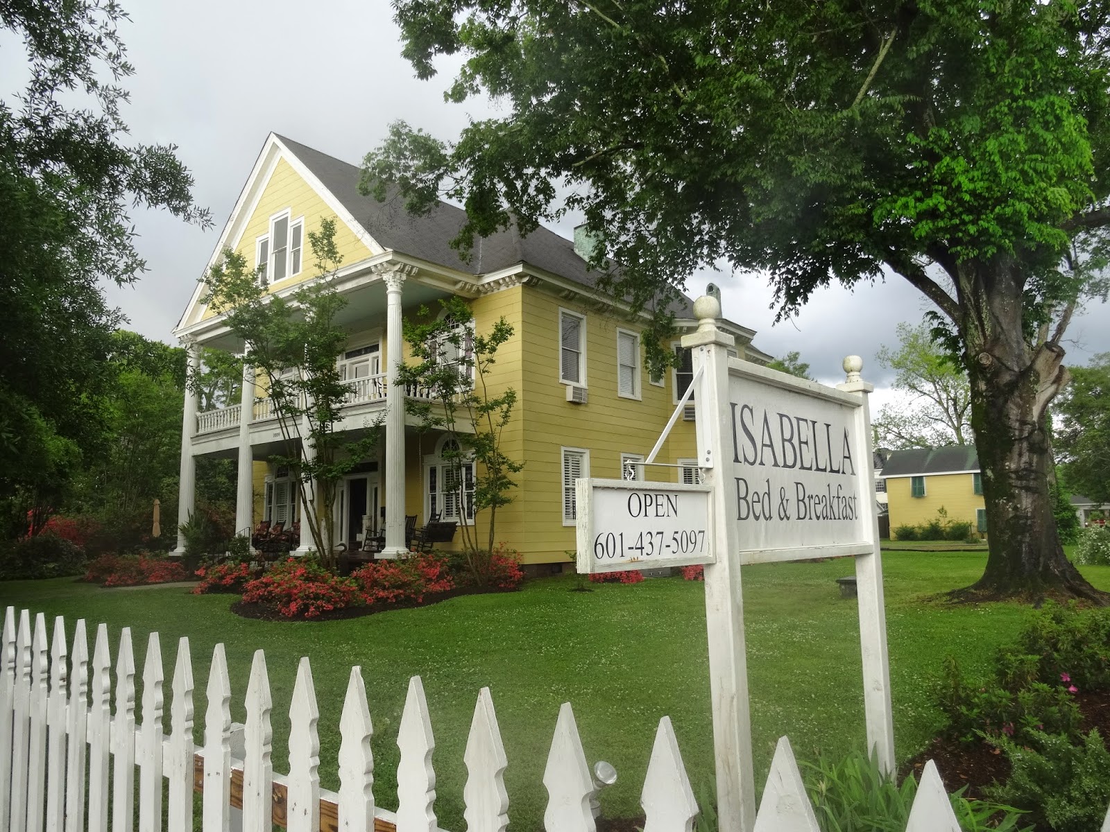
The Towns and History of Mississippi are linked by the Trace, and we enjoyed staying in bed & breakfast facilities in Natchez (where we started), Port Gibson, Kosciusko, and Houston (just south of Tupelo).  These evening stops gave us a first hand look at the beautiful mansions of the past, as well as the economic struggles of the present, neither of which are visible on the Parkway.  In suburban Jackson, we stayed the night in new town Ridgeland, where recently developed bike trails made negotiating modern traffic a bit easier (except for a scary traffic circle where the designated bike lane disappeared).  A shuttle service facilitated the trip, and we only had to carry a few clothes, some snacks for lunch, and water.  All in all, the trip was just the right combination of natural attractions and human comforts.

Parkways are a short branch on the evolutionary tree of transportation.  The first parkway, a term which now applies to any landscaped thoroughfare, predates automobiles.  Frederick Law Olmstead, the designer of Central Park, developed a parkway in the late 19th century in Brooklyn to segregate pedestrians, bicyclists, and horse carriages from one another as well as create a tree-lined linkage between public parks.  In 1908, William K. Vanderbilt, an early automobile enthusiast, constructed a limited access parkway with overpasses on Long Island that was conducive both to pleasure trips and auto races (until they were banned following several fatal accidents).  Portions of both of these early parkways still exist, and have in places now been converted to bicycle trails.

Parkways enjoyed their greatest popularity in the 1920s and 1930s as an urban planning tool and as a forced marriage between cars and parks.  However, after World War II, the increased speed and popularity of automobiles, the rise in commercial traffic, and the development of the freeway ended the segregation of cars and trucks.  Pedestrians and bicycle were either banished or forgotten as a transportation mode for several decades.

Fortunately, bicycling has enjoyed a resurgence in the last few years as Americans become more conscious of their own health and the health of the environment.  The use of bikes for both recreation and utilitarian transportation has been aided by the repaving of old railroad right-of-ways and by the creation of bike lanes on urban streets.  We were pleased to discover a rails-to-trails conversion on our trip:  The 44-mile Tanglefoot Trail with a terminus in Houston, Mississsippi.  These segregated bikeways are now the safest and most enjoyable ways to experience nature on a bicycle, but the Natchez Parkway offers a wonderful trip through history and a wonderful experience in the evolution of transportation.

If you go:  
Start your planning with the help of the National Park Service and the Natchez Trace Compact

We are able to book bed & breakfast lodging, and get helpful tips from NatchezTraceTravel.com

The entertaining and helpful Karla Brown provided our shuttle service

Great bike repair is available in Ridgeland, Mississippi at The Bike Crossing (thank you!)

If you are looking for good Rails-to-Trails for biking throughout the US, go to TrailLink

A word on safety: the traffic was light and drivers considerate on our trip, but there is always the danger of drivers who are inattentive due to sleepiness, substance abuse, or in-car distractions.  We wore highly visible colors, had reflective equipment and outfitted our bikes with bright flashing lights in front and back.

Thank you to the kind people of Mississippi for their hospitality, the staff of the National Park Service for their help, and Anna for the photos

Tuesday, February 11, 2014

Tracks, Trails, and the Value of Nature

Get outside! This winter has been long, cold, and stormy, but rather than admit defeat I headed to the Upper Peninsula for a few days of snowshoeing and cross-country skiing. And while making my own tracks, I discovered the tracks of the others who enjoy the outdoors, both animal and human.  Following a trail got me thinking that perhaps land preservation efforts should be linear, as well as holistic.

Land Preservation Looks Rectangular when one examines a map of any area that identifies property ownership west of the Appalachians, thanks to the Public Land Survey System originally devised by Thomas Jefferson.  I started my weekend by scouting a map of the area north and east of Marquette, Michigan trying to locate a parcel that had recently been donated to The Nature Conservancy (TNC).  I saw a quilted pattern of state-owned land, protected timber lands, in-holdings, and the brightly identified protected sites, including TNC's Echo Lake Preserve.

Exploring Little Garlic Balds Preserve

All of this is in the Michigamme Highlands, an area where the glaciers exposed some of the oldest rocks in North America: granitic outcroppings, or balds, that are home to unique plant communities.  While there are extensive public land holdings in the area, the region's ecological integrity is threatened by unsustainable logging, mining, and scattered site development.  Fortunately, The Nature Conservancy and other groups have secured several preserves thanks to legacy gifts from landowners, generous donors, and the creative purchase of development rights of timber lands. The latter was part of the Northern Great Lakes Forest Project, the so-called "Big Deal," which is Michigan's largest conservation effort.

The Blue (and White) Blaze.  Cutting across the map of patchwork squares on my map was a squiggly line, giving creative character to the right-angle polygons of property lines.  It ran from the entrance to the Echo Lake Preserve, nicked the corner of the new preserve, and ended at the Little Garlic River Falls.  This is a spur of the North Country Trail, an aspiring Appalachian Trail that runs from upstate New York, down through Ohio, and up and across both of Michigan's Peninsulas, before heading north to Minnesota's Boundary Waters and then west to North Dakota.

In 2006, I followed the blue blazes which mark the North Country Trail as I hiked from the Mackinac Bridge to Marquette.  But there, the trail has gaps, and there is no dedicated trail across the wilderness northeast of Marquette.  Several temporary routes have been marked, maps have been carefully perused, and at least two trails have started off only to end up short. I had been stumped before in this area, and I was pleased to soon find myself on snowshoes following the white blazes that mark a spur of the North Country Trail.

Tracks among the Trails.  In winter, snowshoeing offers one of the best ways to get outside.  Not only do you gain the ability to forge through deep snow, but the physical exertion involved quickly warms you up.  Even though the morning temperature had read 3 F when we left the car, in less than 30 minutes I was shedding a layer of down.  At first, we easily followed the well compacted tracks of previous snowshoers; soon we headed off on our own to find the new TNC preserve.  Liberated from the need to follow a trail, but cognizant of our location, we were able to explore a frozen wetland, examine a wooded deer yard, and then follow an iced stream back to the Little Garlic River.

Of course, we left our own snowshoe tracks, but several days without new snow presented us with a view of many other tracks.  We saw the regular route of red squirrels from tree trunk to tree trunk, a deer path defined narrow but deep by hoof prints, and the delicate markings of a small, but brave rodent.  I was most intrigued by a path on a frozen pond that looked as if it were made by someone dragging a small sack, or rolling a ball.  It took the experienced Tina Hall, TNC's chief in the UP, to inform me that we were observing the track of an otter sliding along on its belly between holes in the ice.

A Linear Approach to Land Preservation.  Looking at curving lines on a map, examining haphazard markings across the landscape, and following official blazes, got me thinking about how trails might help guide and inspire conservation efforts. We have shifted in our perspective of land preservation, and increasingly we are asking what the human benefit will be from environmental protection.  While the notion of untrammeled wilderness still appeals to me, the historical record shows that humans have long influenced landscapes (see my previous blog post), and the scale of the impact of humans on the planet has caused scientist to label our current geological age as the Anthropocene. We cannot separate ourselves from the land.

The question before us as conservationists is how to determine the proper, sustainable relationship between humans and the natural world, both in terms of minimizing our impacts and appropriately valuing the benefits nature provides us.  In a time and place where too few people are getting outdoors, trails of all manner provide an increasingly popular way for people to appreciate the benefits of nature. Whether it be hiking or snowshoeing on a footpath, or biking on an old industrial rail line converted for human-powered transportation, trails give quick and enjoyable access to the outdoors.

The Nature Conservancy has long accommodated trails.  Hiking routes on preserves, as well as long-haul routes like the North Country Trail, cross TNC property.  The "Big Deal" in the UP protects privately-owned natural lands, that accommodate both sustainable logging as well as recreational uses.  In addition to foot trails like the Fox River Pathway being restored by TNC, other linear uses are accommodated on TNC preserves.  For the last two years, the UP 200, a popular dogsled race out of Marquette, has crossed TNC preserves.  And in the Two-Hearted River Forest Reserve, TNC has worked with snowmobile clubs to provide bridges and locate trails to improve safety and allow for access to the north woods.  The bridges are part of important work to reduce erosion and polluted run-off into the trout stream made famous by Hemingway (see this slide show).

Economic Benefit of Trails.  The Upper Peninsula has a long and checkered history of using its natural resources for economic gain.  This history came to the forefront on the second day of my winter outing when I put on cross country skis to explore the snow-covered Iron Ore Heritage Trail.  This recently developed trail follows an old rail line from downtown Marquette to the community of Republic, 47 miles to the west.  Opening this past summer for use by bikers and hikers, this paved trail in winter is used mostly as a snowmobile trail.  However, the historic stretch between Negaunee and Ishpeming is groomed as a cross-country ski trail.  I appreciated the gentle grade and the well-set tracks.

The trail passes the Jackson Mine, the first iron ore mine begun in the Upper Peninsula, and I was moved skiing into the relatively small pit that workers began to dig out in 1847. The human ingenuity and hard work, the lasting impact on the land, the boom and bust economy, and the now legendary history are all tangible on the new trail.  Well-done interpretive signs, remnant pieces of mining equipment, old buildings, and deep pits hewn into the rock all make the Upper Peninsula's historical relation to nature very real.

Now, instead of extracting wealth in the form of minerals from the soil, Michigan has discovered the economic benefits of trails, associated tourism, and their improvement to quality of life in our communities.  While a wide body of research shows the economic and community benefits of trails (read more here), our practical experience has also grown.  Heavily used bike trails now abound in much of the Lower Peninsula, snowmobile trails keep the Upper Peninsula busy in winter, and Marquette and other communities have established celebrations around dogsled races and other outdoor pursuits.

Nature has value.  Those of us who head to the woods or waters know the personal and spiritual benefits we get from time outdoors. We also understand that clean water and a favorable climate also come from nature, as long as humans act as responsible stewards.  Increasingly, we see that nature can also help us build a sustainable economy around agriculture, logging, and tourism when those activities are undertaken with thought and foresight. Trails create value by giving us access to the outdoors, by promoting responsible use of nature by locals and visitors alike, and by helping us create an awareness and appreciation of places. Perhaps we can use trails to better connect human communities to the natural communities upon which they depend, and make us neighbors rather than adversaries.


If you want to get out in the UP this coming weekend, join a guided snowshoe hike at the Gerstacker Preserve east of Cedarville on Saturday (2/15); info here

If you want to visit TNC Preserves in the Marquette area, and gain some tips for exploring them in warmer weather, read this blog post

Get all the details on the UP 200 Dogsled Race here

You can learn more about the Iron Ore Heritage Trail in Marquettte, and get directions and maps, here


thanks Tina 
(and Bruce) for the hospitality